|
|
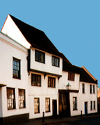
137 Fishpool StreetThis was originally built as a 15th/16th century 'Wealden" house but has been much altered over the years. 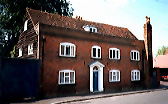
137 Fishpool Street today |
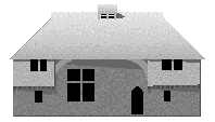
A Wealden house |
Immediately
outside the town boundary was the Abbots Grange of
Kingsbury and the house now known as Kingsbury
Manor is partly of late medieval date. Like the
Grange
of St. Peter this was
threatened with destruction in 1381 and later
strengthened by Abbot John Moot (1396-1401) and
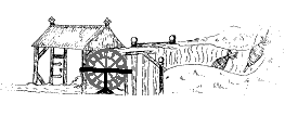
provided with an earthwork defense. Moot also built
a barn to store the estates produce and this
still survives although one of its aisles has been
demolished. above- Reconstructed
cross section of the timber framed barn built by
Abbot Moot c.1400.
Kingsbury
Grange
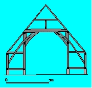
below - aisle post of barn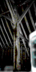
Where Kingsbury Mill is today
was the site of the Abbots Malt Mill. The Domesday
Book of 1086 records three mills for St. Albans but
their location is uncertain. However the Malt Mill
was in existence by 1194. Work was carried out on
the mill by John Whitby for Abbot Wheathampstead
(1420-1440). The mill was described in 1658 as St.
Michael's Mills, "formerly a Mault
Mill".
The
Malt Mill
Malt
Mill Bridge
The St. Albans Turnpike
Trust, established in 1715, had built in 1765 at a
cost of £280 St. Michael's Bridge over the
River Ver and this is now the oldest extant bridge
in Hertfordshire. This was not the first bridge
here for a bridge over the river was mentioned in a
contemporary account of the Second Battle of St.
Albans in 1461 and recorded as "Pons de la
Maltemyll" in 1505.
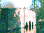
The present St.
Michael's Bridge
Fishpool
Street
Malt Mill BridgeThe St. Albans Turnpike Trust, established in 1715, had built in 1765 at a cost of £280 St. Michael's Bridge over the River Ver and this is now the oldest extant bridge in Hertfordshire. This was not the first bridge here for a bridge over the river was mentioned in a contemporary account of the Second Battle of St. Albans in 1461 and recorded as "Pons de la Maltemyll" in 1505. |
The present St. Michael's Bridge |
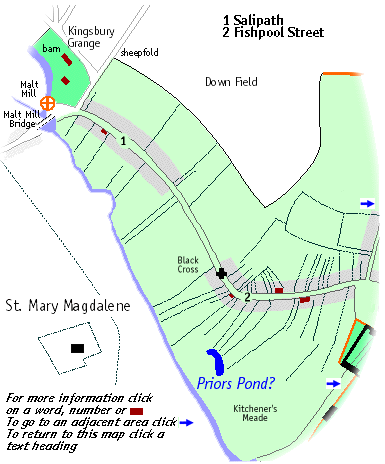
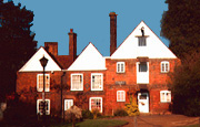
This is one street which certainly bore its name before the Norman Conquest. This came from the great fishpool from which in Saxon times the inhabitants of the royal estate of Kingsbury gained a livelihood. At the lower end of the street the properties on the northern side of the street ran back to Downfield and at the upper end back to the toft of Squillers. On the southern side the properties stretched down to the river at the lower end and at the upper, back to Kitchener's Mead. This was named after the Kitchener of the Abbey. In 1538 the Abbot leased to Henry Gape a tenement described as stretching from the highway in the north to the Prior's Pond on the south, towards the "Kechener's Meade". This pond will have been one of the Abbey's fishponds and was perhaps situated where there was still a pond in the early 19th century.
Black Cross
Once part of the Crow Inn was
built with a jettied upper storey around
1500.
13-15
Fishpool Street
38-40
Fishpool Street
![]()